 magyar
 english
 slovakian
 serbian
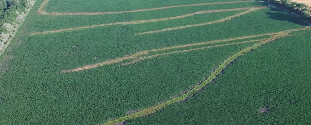
One of the fundamental requirements of precision farming is the establishment of appropriate field conditions, which includes carrying out appropriate water management activities, and any failure to do so can lead to significant yield losses and also negatively affect soil conditions. In our country, on average over 10 years, there are regularly 2-3 years of waterlogging and 2-3 years of drought. These often occur in the same year and for the most part in the same region, and increasingly frequently in the same agricultural field, while at other times they can vary in space and time. A significant part of the country’s more than 50,000 km2 of flat land (about 45% of the country’s territory) is at risk of inland water.
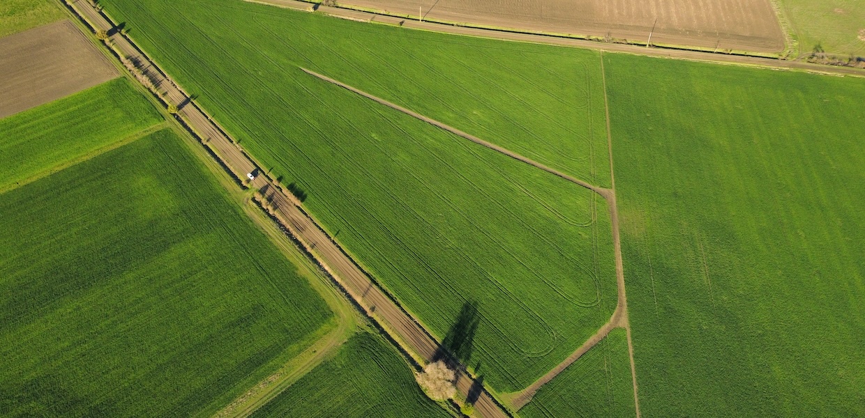
The increasingly extreme spatial and temporal distribution of precipitation is leading to extreme water balance conditions in arable land, which poses significant challenges for crop production. The agricultural attribute of our country is fairly diverse in terms of elevation; farming is carried out everywhere, from hilly areas through gentle slopes to extremely flat, low-lying areas. The formation of waterlogging is a common problem in flat, undrained areas, however KITE’s shallow-ditch management service provides an effective solution for managing these otherwise harmful surface water surpluses.
Surface water utilization and management
KITE offers a complete solution to the problem of harmful surface water surpluses through its systems supporting water management in flat and hilly areas. KITE’s surface water management service consists of a sophisticated assessment, planning and execution process carried out by our precision farming consultants using specialist equipment and software. The main objective is to retain the water rather than drain it off.
In the planning phase, the planning of the landscaping is carried out virtually, which requires some basic data:
- field boundary
- the elevation grid of the area
- the outflow position of the planned shallow ditches
- the position of objects that may hinder subsequent implementation
The data is processed in a specialized GIS software environment, which can be used to model the individual processing measures, thus automating certain parts of the process, and reducing the processing time.
Based on the collected three-dimensional data, our engineers create a high-resolution elevation model that serves as the basis for designing the inland water drainage system. Since our precision farming consultants are in contact with our partners, the necessary additional information (location of channel and dirt roads adjacent to the field, position of man-made objects within the field, local specifications) is constantly collected and passed on for planning. The shallow ditches for inland water drainage within the field are designed in the ESRI ArcGIS GIS software environment, which allows the depth of the planned excavation and the length of the planned ditches to be calculated to within a cm. In some cases, there are also low-lying flat areas where inland water is a problem not only in certain parts of the field, but in up to 70-90% of the area. In this case, the solution is to design a trench system.
Once the plans are approved, the construction process can begin. The shallow ditches are created using a Wolverine Extreme ditcher towed by a John Deere 8R tractor. Each device is equipped with a GPS antenna; the StarFire 6000 antenna on the equipment continuously detects changes in topography during the work, while the StarFire 6000 antenna mounted on the tractor provides automatic control via the AutoTrac system on the pre-designed shallow ditch route. The Wolverine Extreme has 3 rotating shovels that loosen the soil layer and then removes it. Shallow ditch preparation is usually a slow process, as the travel speed is around 1±0.5 km/h, while the Wolverine Extreme ditcher removes 10-12 cm of soil in one go, as it creates the right slope for the shallow ditches depending on the characteristics of the field and the inundated area.
In the zones around the shallow ditch, the crop will have a higher potential, as the water retention of the ditch supplies the areas around it with moisture. With this approach, the farmer can, depending on the size of the fields and the amount of excess surface water, recover as much as several additional hectares of land, bringing uncultivated areas back into productive use.
Our related services
- Precise survey of the elevation of the field
- Advanced shallow-ditch layout planning using cutting-edge GIS technology
- 3D shallow-ditching/implementation using the latest equipment
- 3D ditch-track maintenance