 magyar
 english
 slovakian
 serbian
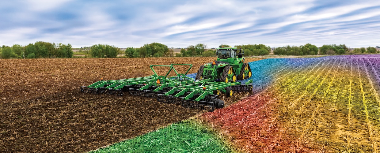
32% of Hungary is hilly land, over 200 meters above sea level. Fields on the hillsides is exposed to erosion. Around 40% of the cultivated area of our country is at risk of erosion, which significantly reduces the quality of the soil and thus the success of farming activity. A significant proportion of the field area on the hillsides falls into slope category III, i.e. a gradient of above 12%, and is therefore exposed to increased risk of erosion.
Accordingly, in the “Conditionality Regulation”, the Good Agricultural and Environmental Condition (GAEC) requirements now include procedures for reducing the risk of soil degradation and soil erosion. Thus, producers who farm on sloping land and wish to receive aid are obliged to comply with the requirements, which they can only successfully do by applying various technological solutions. Soil protection and the improvement of arable land areas for sustainable production are essential prerequisites for precision farming as well, which is why KITE has been systematically addressing the issues of field water management for more than 10 years. As a result, inland water management is now available as a service, and the improvements in geographic information systems (GIS) and the practical experience gained are enabling KITE to support farmers in adapting sustainable farming solutions in areas affected by erosion.
Soil erosion is one of the main problems in sloping, hilly areas, and in many cases this can be remedied by the use of conservation tillage systems (reduced-tillage, strip-tillage, no-till), but there are cases – such as areas with slope steepness of more than 12% – where these no longer provide sufficient protection against erosion. In these cases, it is appropriate to apply contour farming, where the various field operations (tillage, planting, harvesting) are carried out on or near the elevation contour lines so that the direction of the operations is always perpendicular to the direction of the slope, thus reducing the speed of run-off water.
A prerequisite for the implementation of contour farming is therefore the assessment of the topographic data and the preparation of a digital elevation model of the field based on these data. The digital elevation model enables us to plot the contour lines, which is done taking into account local erosion conditions, slope length and gradient. The contour lines are generated in a format that can be traced by the field machinery, so that the work is always parallel to the drawn contour line.

In addition to the digital elevation model, the high-precision, detailed topography data also provide an opportunity to create a slope gradient map, so that the areas that are particularly affected by erosion (slopes exceeding a gradient of 12%) can be delineated. The delineated areas are also exported to a format which could be uploaded to the display of the tractor to ensure that they can be clearly identified on the ground by the operator of the field machine, thus assisting the topography-based planning process. This is also essential for marking out those parts of the field where tillage can only occur in the direction of the steep slope and thus even contour tillage will not prevent erosion. Such areas should be taken out of cultivation and sown with perennial crops, as yields are often low there anyway.

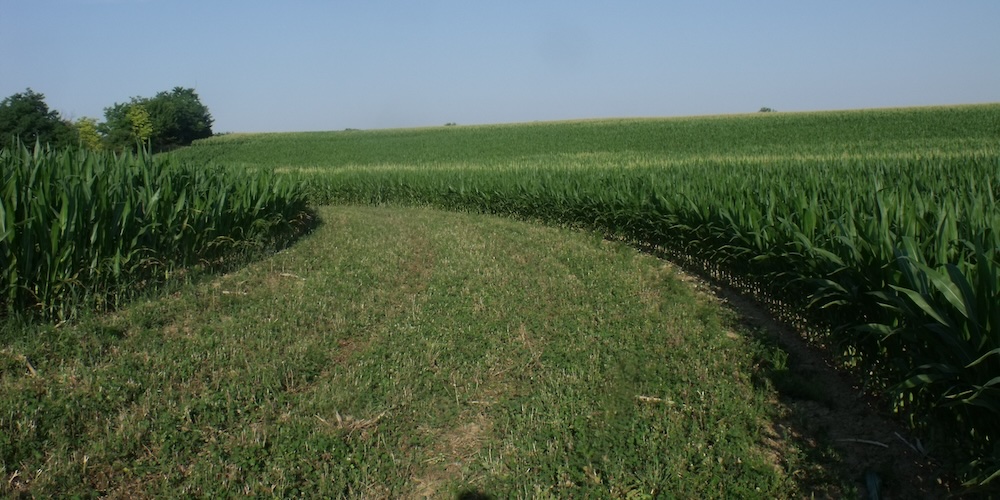
In addition, if a slope gradient exceeding 12% is combined with a slope length of 100 meters or more, erosion-control strips planted with perennial crops are also required, which must likewise be created along the drawn contour lines. These can also effectively slow the movement of water down the slope from harvest time until the spring-sown row crops are fully established.
The above solutions – ranging from contour farming to erosion-control strips – can only be implemented through relief-based planning, and only then can they prevent soil loss due to erosion.
Our related services
- Preparation of a detailed elevation model (for other services too)
- Preparation of contour farming as required by law
- Slope gradient map and delineation of areas with a gradient of more than 12%
- Providing documentation in shapefile format
- Production of documentation in printed/printable format
- Presentation of the planning results by a consultant in a personal consultation
- Optionally, creation of a multipoligon-based zone map
- Optionally, precision soil sampling based on the multipoligon zone map