 magyar
 english
 slovakian
 serbian
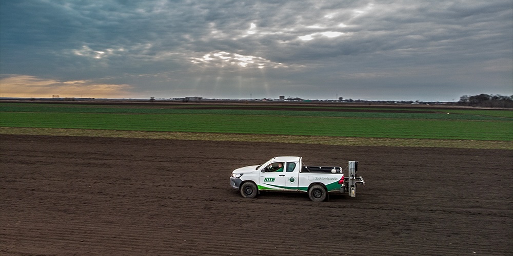
In line with good farm management principles, soil samples must be taken every 5 years from the top 30 cm of soil per 5 hectares and tested by an accredited soil laboratory at least as part of a limited test.
It’s not just an obligation, but an opportunity to gather valuable information! Soil sampling and nutrient management are essential cornerstones of crop production. Focusing not only on the soil, but also on the needs of the plant, KITE Zrt. puts great emphasis on the quality and traceability of soil sampling, as this is the basis for nutrient management for years to come.
The key to accurate planning
In terms of the nutrient management, the biggest cause of error is the incorrectly conducted soil sampling. A representative soil sample – one that accurately characterizes the sampled area – is therefore a key prerequisite for effective planning. The soil samples characterizing the zones are made up of at least 20 sub-samples and from a uniform depth, thus ensuring that the entire area – which is on average 3-5 hectares depending on the method of zoning and the characteristics of the area – is well represented.
Where should we take soil samples from?

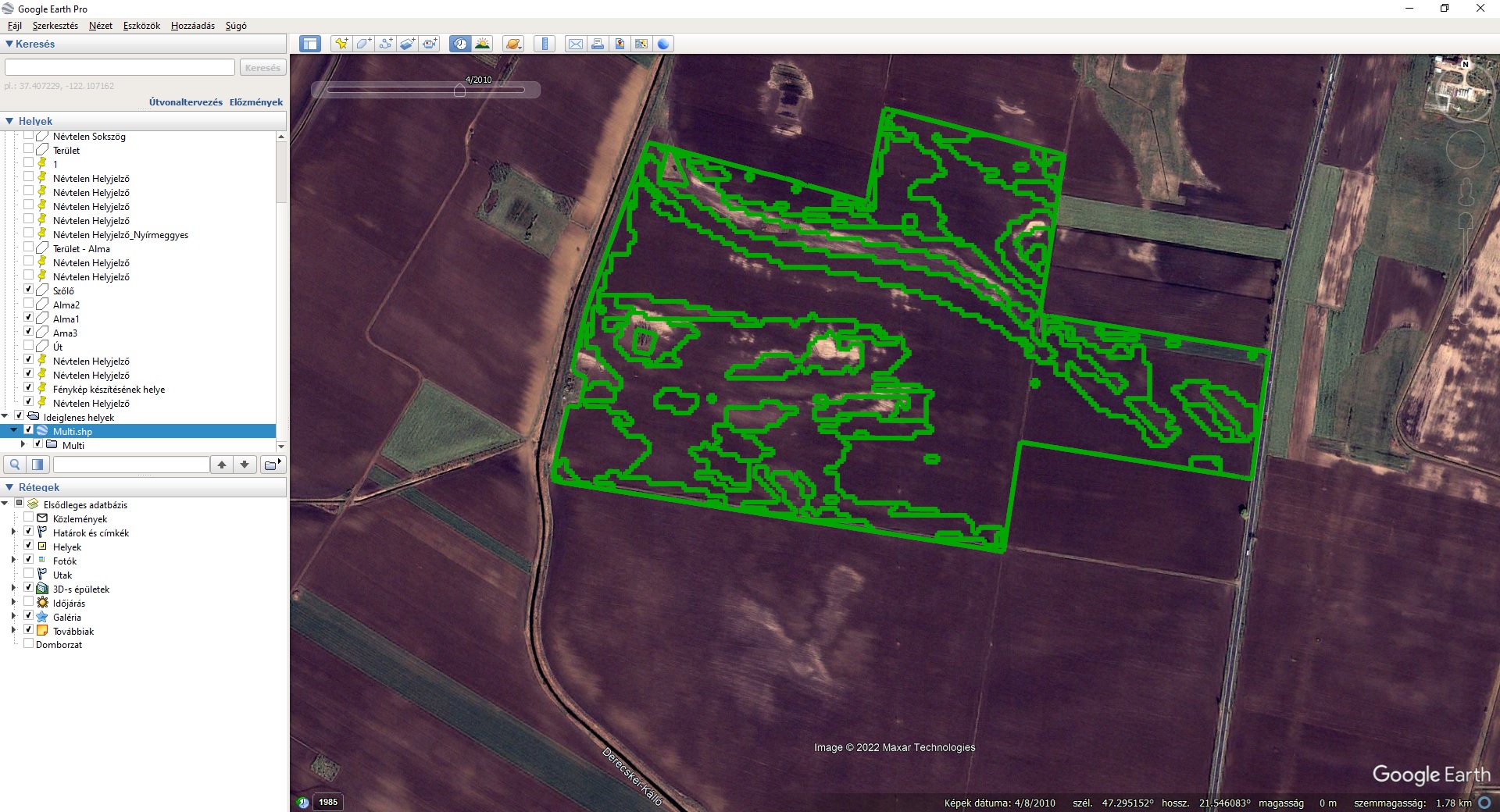
Of the various items of information collected from the field, the soil analysis results are of particular importance, as these can also be used in nutrient management and soil improvement planning. It is important, therefore, to treat areas that can be considered similar in terms of soil parameters jointly together. However, parts of a field that are similar to each other are often not contiguous. For this reason, it has proved necessary to adopt a multipolygon zoning approach, where various zones delineated using topography and productivity parameters can be located in several different patches within the field in accordance with the true heterogeneity of the field.
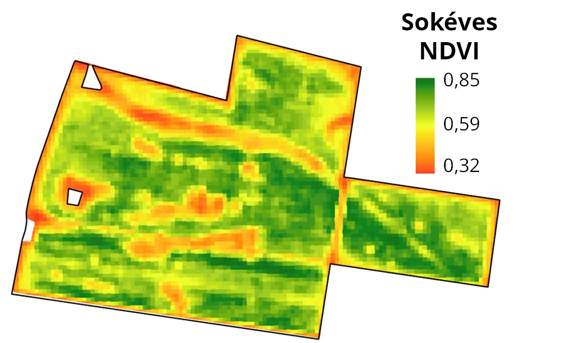
What does the zone map show?
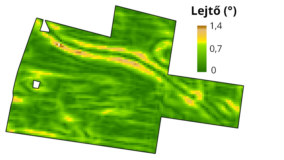
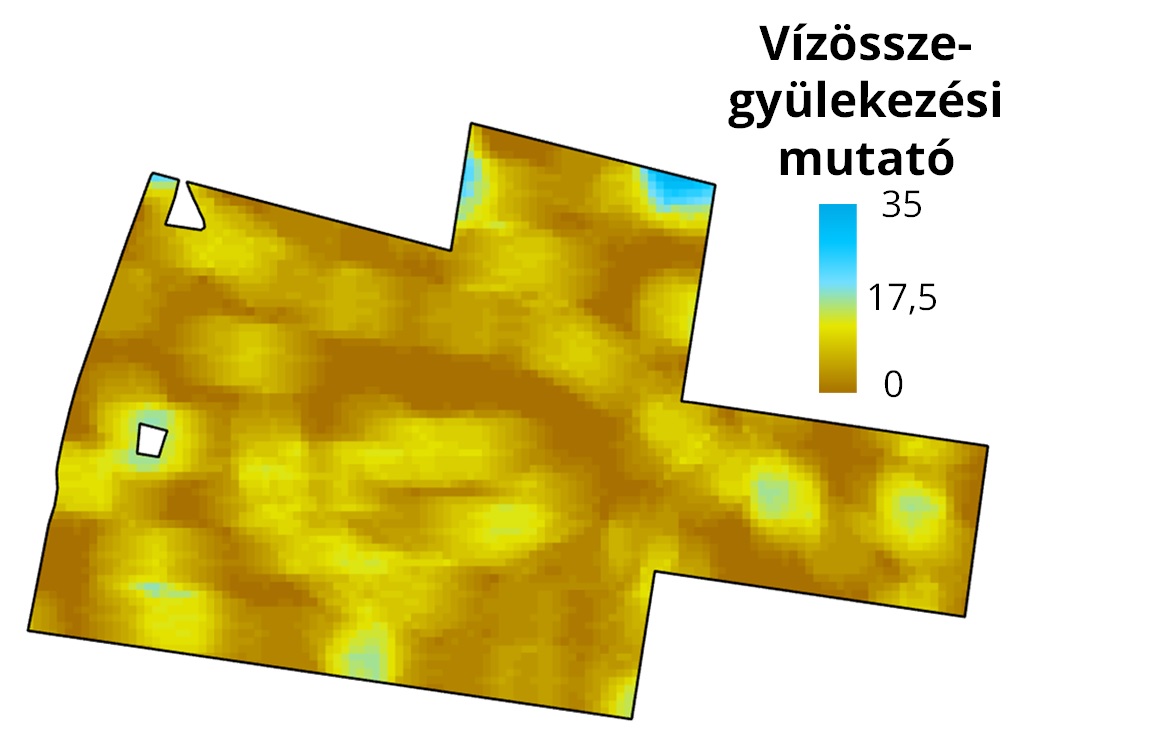
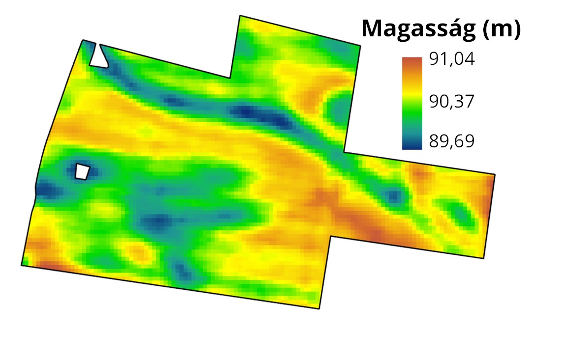
Relief also matters!

The validity of the multipolygon zones was also checked with the use of soil maps since the development of soil parameters is closely related to the occurrence of different soil types. However, the characteristics of the zones differ not only in terms of their nutrient supply capacity, but also in terms of their water management properties, and thus in addition to sampling, multipolygon zones can also serve as a basis for variable rate irrigation (VRI). As you can see in the maps below, we have categorized the areas prone to waterlogging into one zone, while we can also treat the higher-lying areas with good yield potential jointly, regardless of the fact that they are not located next to each other within the field. Parameters derived from the digital elevation model (DEM), such as the slope, or the potential drainage density parameter (PDD) describing the probability of water accumulation and the landscape dissection as well as the DEM itself and the long-term NDVI that characterizes productivity, provide useful information for delineating the various soil patches.
Track and trace
The traceability of the sampling, i.e., the geo-referenced sampling, serves the interests of the farmers, as they receive information on the latest status of the sampling and can be sure of its correct implementation. The sampling vehicles used by KITE Zrt. are equipped with GPS and automatic sampling units. For both conventional and precision mechanical soil sampling, a real-time sampling route is recorded. The process is fast, accurate, repeatable, and documented, and can be verified by the partners at all times.
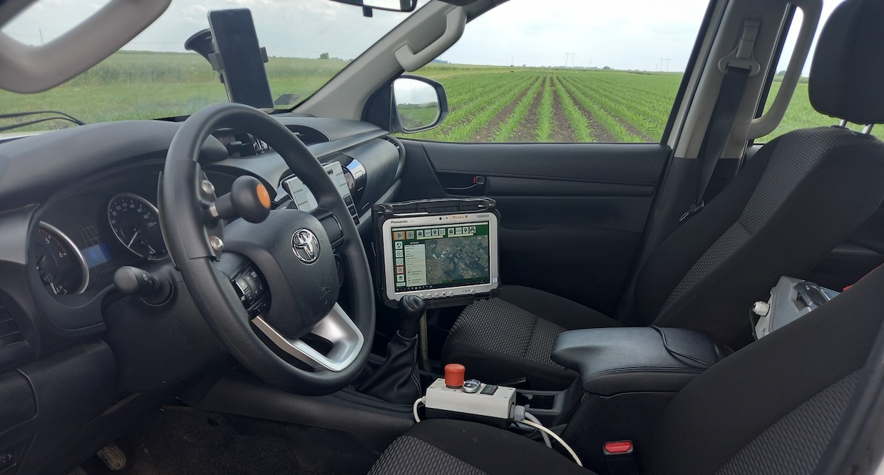
A fleet of 10 sampling vehicles
Proprietary hardware and software-equipped sampling vehicles provide the basis for the service. From data uploading to the arrival of the laboratory data, data is processed in a single, closed system. The work can be monitored live by the partners as well.
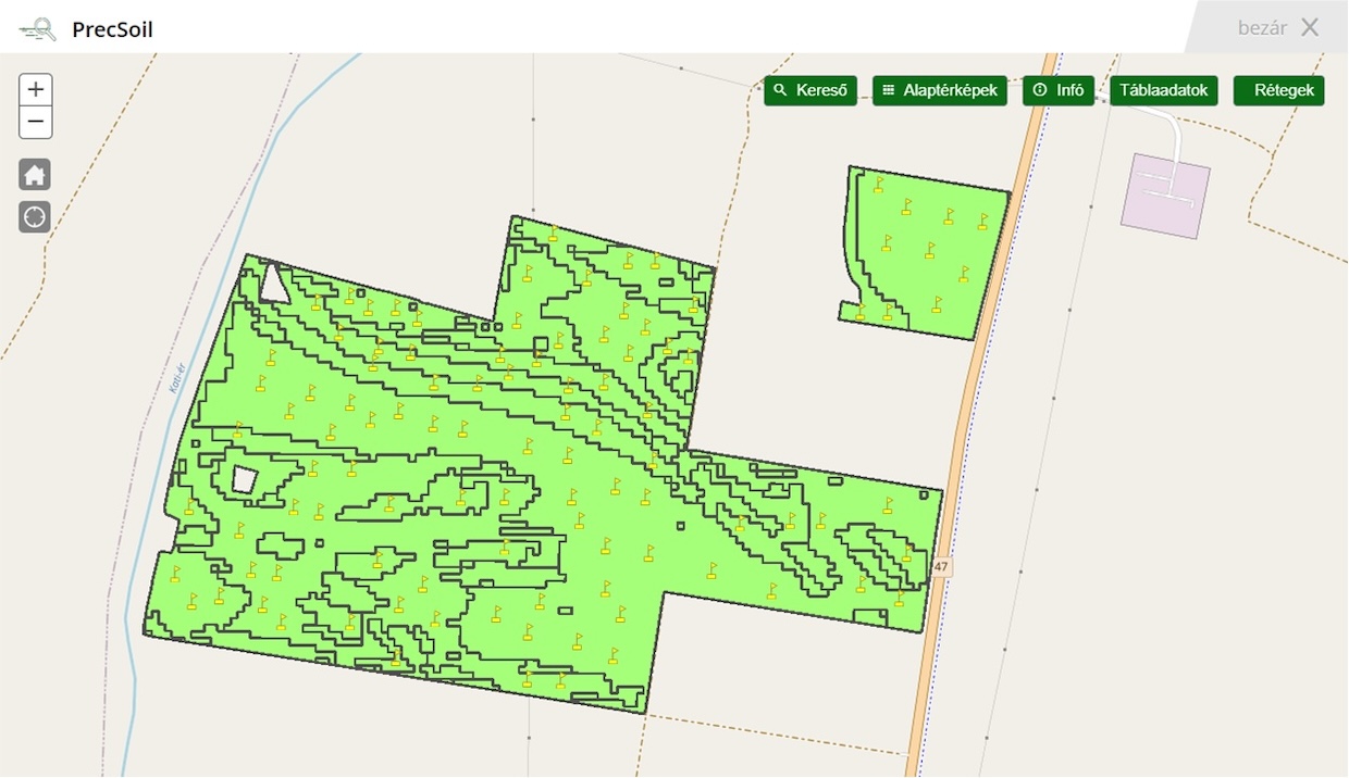
The sampling points can be viewed together with the zones in the Soil sampling app.
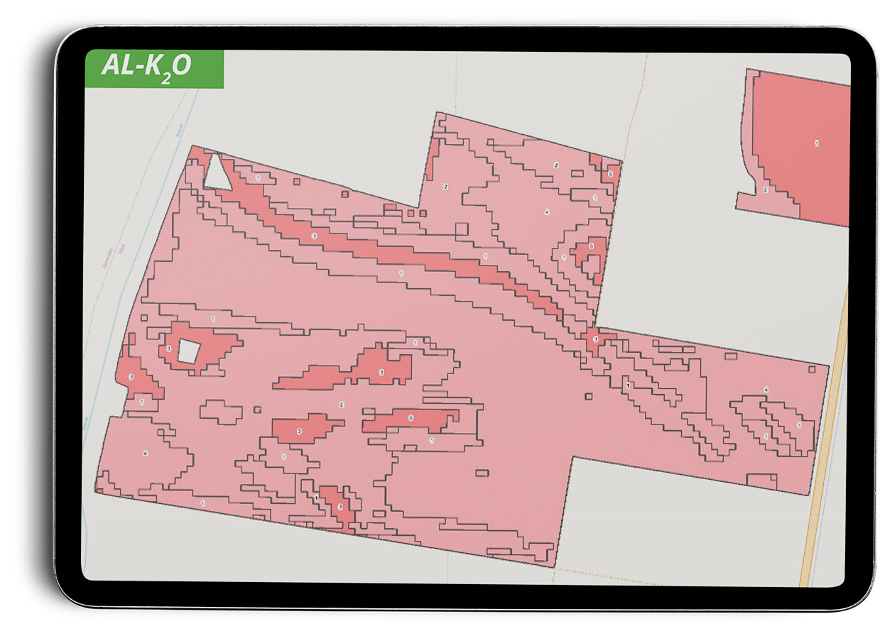
SOIL ANALYSIS RESULTS
Precise knowledge of the field
The chemical parameters of the soil, such as the phosphorus and potassium content soluble in ammonium-lactate acetic acid (AL), which characterizes its nutrient supply capacity, the humus content, and the pH or texture of the soil, all provide information on the soil without which site-specific farming cannot be conducted.
The soil parameter values defined for each zone are stored in the PGR, and can be used directly in the subsequent planning processes, be it nutrient management, irrigation or soil improvement.
The soil parameters can be displayed on all the fields of the farm at the same time in the Soil sampling app, which helps the user to identify the differences between the fields and to obtain a rapid overview of the test results
We provide up-to-date information on the amount of mineral nitrogen that can be taken up by plants.
View your soil analysis results in map form!
The soil parameters can be displayed on all the fields of the farm at the same time in the Soil Sampling app, which helps the user to identify the differences between the fields and to obtain a rapid overview of the test results.
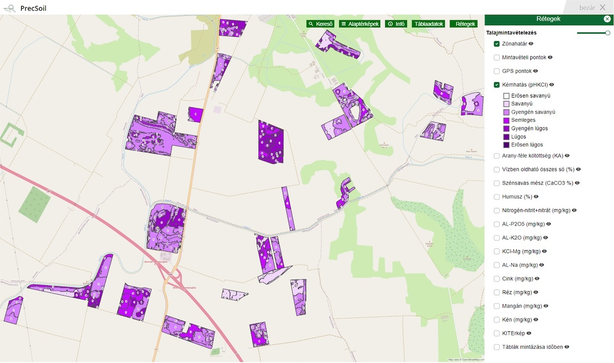
In the Soil sampling app, you can view the spatial development of the soil parameters. Differences in the nutrient-supply capacity of the soil within the field are displayed and soil degradation problems affecting individual parts of the field can be recognized, such as soil acidification or excessive carbonate content due to erosion. In addition, the productivity map of the field can be viewed in the app.
Our related services
- Our consultants create the digital elevation model (DEM), slope steepness and PDD map of the field in a resolution of 10x10 meters using a GIS software
- The multipolygon zones are created based on the relief parameters and the long-term NDVI, the design of which requires a high level of GIS expertise
- Traditional, precision-based and multipolygon “high-end” soil sampling
- Soil profile examination
- Creation of a soil conservation plan
- Leaf analysis
- Measuring of mineral nitrogen with a mobile lab
- Accredited lab testing for 14 parameters
- Through the Soil sampling app, our partners receive detailed information on their soil analysis results related to their fields
- The productivity maps, the established management zones, as well as the route and sampling points of the precision soil sampling are all accessible to our partners